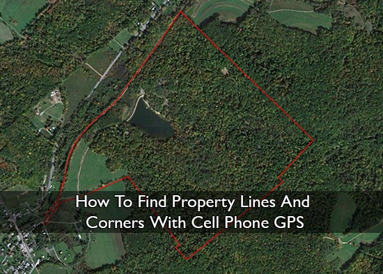
How To Find Property Lines And Corners With Cell Phone GPS
Make sure to like Living Green and Frugally on Facebook, Shop at Amazon to help support my site and explore our PINTEREST BOARDS for innovative ways you can become self-sufficient.
Finding property lines and corners is essential for various purposes, such as erecting fences, building structures, or simply understanding the boundaries of your property. With the advancement in technology, you can now use your cell phone GPS in conjunction with ExpertGPS software to accurately locate these lines and corners. This article will guide you through the process.
What You Need:
- A Cell Phone with GPS Capability: Most modern smartphones have built-in GPS that can be used for this purpose.
- ExpertGPS Software: This is a powerful tool for managing GPS data and maps.
- Property Deed and Survey Maps: These documents contain the legal descriptions of your property boundaries.
Step-by-Step Guide
1. Gather Your Property Information
- Property Deed: This document includes the legal description of your property boundaries.
- Survey Maps: These maps provide a visual representation of your property lines and corners.
- Coordinate Data: If available, gather any known coordinates of your property corners from previous surveys.
2. Install ExpertGPS
- Download and install ExpertGPS from ExpertGPS Official Website.
- Follow the installation instructions provided on the website.
3. Import Your Property Data into ExpertGPS
- Open ExpertGPS and import any digital maps or coordinate data you have.
- If you have a paper map, you can scan and georeference it within ExpertGPS.
- Enter the coordinates of your property corners if they are available in your property deed or survey.
4. Convert Legal Descriptions to GPS Coordinates
- ExpertGPS can convert legal land descriptions (like metes and bounds) into GPS waypoints.
- Input the descriptions from your property deed into ExpertGPS to generate the GPS coordinates.
5. Export GPS Coordinates to Your Cell Phone
- Once you have your property corners identified and marked in ExpertGPS, export these waypoints.
- Export the data in a format compatible with your cell phone GPS app (e.g., GPX file).
6. Load Waypoints into Your GPS App
- Transfer the GPX file to your cell phone.
- Use a GPS app on your phone that can import GPX files. Popular options include Gaia GPS, ViewRanger, or Google Earth.
- Import the GPX file into your chosen app.
7. Navigate to Your Property Corners
- Open the GPS app on your cell phone and load the imported waypoints.
- Use the app to navigate to each waypoint, which represents a corner of your property.
- Walk to each waypoint, and you can mark these corners with physical markers if needed.
Tips for Accuracy
- Clear Line of Sight: Ensure there are no obstructions like buildings or dense trees that could interfere with GPS signals.
- Use High-Precision GPS: Some smartphones offer high-precision GPS modes that can improve accuracy.
- Check Satellite Reception: Make sure your GPS app shows good satellite reception before you start navigating.
- Cross-Check with Physical Features: Verify the GPS data with any physical markers or features described in your property deed.
Conclusion
Using cell phone GPS in conjunction with ExpertGPS software makes finding your property lines and corners more accessible and less expensive than hiring a surveyor. By following these steps, you can accurately determine your property boundaries for various purposes. Always ensure that your data is as accurate as possible and cross-reference with legal documents to avoid any disputes.
For more detailed information and support, visit the ExpertGPS website and explore their extensive resources and user guides.
